
Dam Breach Inundation Analysis: Difference between revisions
No edit summary |
Rmanwaring (talk | contribs) No edit summary |
||
| Line 35: | Line 35: | ||
==Best Practices Resources== | ==Best Practices Resources== | ||
{{Document Icon}} [[Federal Guidelines for Dam | {{Document Icon}} [[Federal Guidelines for Inundation Mapping of Flood Risks Associated with Dam Incidents and Failures (FEMA P-946) | Federal Guidelines for Inundation Mapping of Flood Risks Associated with Dam Incidents and Failures (FEMA P-946), FEMA, 2013]] | ||
{{Document Icon}} [[Federal Guidelines for | {{Document Icon}} [[Federal Guidelines for Dam Safety (FEMA P-93) | Federal Guidelines for Dam Safety (FEMA P-93), FEMA, 2004]] | ||
{{Document Icon}} [[Hydrologic Engineering Requirements for Reservoirs (EM 1110-2-1420)|Hydrologic Engineering Requirements for Reservoirs (EM 1110-2-1420) | {{Document Icon}} [[Hydrologic Engineering Requirements for Reservoirs (EM 1110-2-1420) | Hydrologic Engineering Requirements for Reservoirs (EM 1110-2-1420), USACE, 1997]] | ||
==Trainings== | ==Trainings== | ||
Revision as of 21:02, 19 December 2022
|
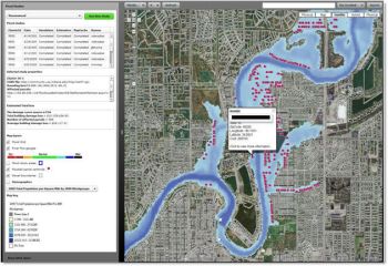
| A flooding inundation map (USGS, 2019) |
“Safety design includes studies to ascertain areas that would be flooded during occurrence of the design flood and in the event of dam failure. The areas downstream from the project should be evaluated to determine the needs for land acquisition, flood plain management, or other methods to prevent major damage. Information should be developed and documented suitable for releasing to downstream interests regarding remaining risks of flooding.” [1]
“The selection of an appropriate model for computing a dam breach is dependent on the type of results needed, the level of effort that can be expended, and the potential for loss of life and economic damages that can result from a dam failure." [2]
“For dams in rural areas where the potential for loss of life is low, a tier 1 level study using simplified methods may be appropriate. For areas where a potential dam breach can result in the loss of life an intermediate tier 2 level or advanced tier 3 should be performed. The intermediate tier 2 level study may be used for areas where more detailed calculations are justified because of the potential for loss of life. Advanced tier 3 level studies may be needed to develop dam breach inundation zone mapping for urbanized areas and for unconfined floodplains.” [2]
Required Data
Types of Analyses
- Hazard Potential Classification
- Consequence Analysis
- Incremental Damage Analysis
- Inundation Mapping
- Emergency Action Planning
Best Practices Resources
![]() Federal Guidelines for Dam Safety (FEMA P-93), FEMA, 2004
Federal Guidelines for Dam Safety (FEMA P-93), FEMA, 2004
![]() Hydrologic Engineering Requirements for Reservoirs (EM 1110-2-1420), USACE, 1997
Hydrologic Engineering Requirements for Reservoirs (EM 1110-2-1420), USACE, 1997
Trainings
![]() On-Demand Webinar: The State of the Practice and Future of Dam Breach Modeling
On-Demand Webinar: The State of the Practice and Future of Dam Breach Modeling
![]() On-Demand Webinar: WinDAM - Overtopping and Internal Erosion for Earthen Embankments
On-Demand Webinar: WinDAM - Overtopping and Internal Erosion for Earthen Embankments
Citations:
Revision ID: 6030
Revision Date: 12/19/2022